Mt Hay, Venus Tor and Boorong Crags
The group: Chris (leader), Geoff, Margaret, Roger, Noel, Damon, Joe, Karin and Don.
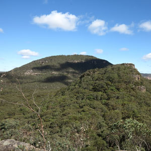
We set off from Mt Hay car park at 8.30 under a clear blue sky, with no wind, but it was quite cold. It was a perfect day for views. We stopped a few times on the way up Mt Hay to take photos, remove layers and, at one spot, try to relocate some Aboriginal grinding grooves found on a previous visit.
It is a very well-marked track with many rock cairns and even some arrows scratched into the rocks. The path over Mt Hay has rocks and branches hidden among the grass, which can make it treacherous. The descent is then made via a well-worn, steep path onto a ridge that runs along the edge of the Grose Valley, with views back to Blackheath and across to Mt Banks and Zobel's Gully.
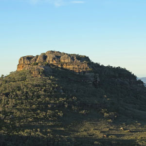
Our next stop was the top of Venus Tor. We all made it along the ledge without incident and spent 20 minutes enjoying morning tea, Don's banana cake and the views down the Grose and back to Mt Hay. It was a great panoramic view across several kilometres of the Grose Valley.
We continued to the eastern part of Boorong Crags before completing a quick loop around the top and heading back towards Venus Tor for the off-track section of the walk.
This took us along the ridge on the northern side of Round Hill Gully. The undergrowth was mainly head-high, but not very dense or scratchy, with some open areas. We continued to the descent point used in 2008 at the end of the ridge and looked down at a section that had involved two tape-assisted drops opposite soaring cliffs.
Fortunately, on a previous visit we had discovered an easier descent by walking west around the ridge to what I call "Black Wattle Pass" at 618 766. It is a steep slope with plenty of black wattles to hold onto on the way down and no rock scrambling. We reached the creek within a few minutes.
This brings you into Mt Hay Creek, an area worth exploring when summer comes, with crystal-clear water, pools and moss-covered boulders. Geoff had previously found an exit point that took us up to a wind-eroded overhang where we had a leisurely lunch. There were no views, just a wonderfully peaceful spot. There is nothing quite like the silence of the bush.
It is an easy exit up the ridge from here to a rocky outcrop where the group photo was taken. On a previous visit we had walked directly from there to the fire trail at Hurley Heights, but I decided to take a slight detour to inspect what appeared in aerial imagery to be open heath or swamp.
It wasn't. The grass was waist-high and so thick you could have built a house on it. It was worth seeing to make sure we never went there again. We returned to the bush and headed south to the fire trail.
Before the walk I had mentioned that rain was forecast for 3.00 pm and said that I wanted to be back at the cars by then. To my amazement—I mean, through careful planning—we returned a few minutes before three. A suggestion from a foxy member of the group that we stop for a drink within sight of the car park was ignored as an obvious attempt to delay us.